Used to manually add a data offset to be used in the calculation.
Data offsets are a critical part of maintaining highly accurate bathymetric and vegetation data. An offset can be used for anything from correcting for the depth of the transducer below the water's surface to identifying depth based on a high or low water mark.
Manual depth offsets
Bathymetric and biovolume outputs can be adjusted to defined depths. These adjustments may vary from offsetting outputs to the depth of the transducer or to adjust outputs to a standard or simulated water elevation.
Positive vs. negative offsets
Positive offsets will uniformly make depths deeper, while negative offsets will make depths shallower. Simply add offsets to account for both the transducer and water elevation (e.g., if your benchmark elevation is 1 ft lower than the depth on the trip date, but your transducer is 1 ft below the surface, then these values cancel each other out and no offset is needed).
Biovolume is also adjusted with offsets. For instance, biovolume will increase (i.e., the heat map will get hotter) if a negative offset is applied (or if tide offsets bring the water elevation down) because the plant length now occupies more of the water column. With a negative offset, if the water depth decreases beyond the plant height, then biovolume will be 100%.
With a positive offset, biovolume will always be less and thus be “cooler” in the biovolume heat map. For example, a 1 ft positive offset will reduce a 100% biovolume reading in 2 ft to 66% (i.e., plant height in this case equals 2 ft and water depth now equals 3 ft). This same offset applied to a 100% biovolume reading in six feet would result in an adjusted biovolume of 86%. Consequently, this results in an arc-like pattern of maximum biovolume values in the summary reports.
Automated tide offsets
One of the biggest challenges of mapping coastal habitats is their tidal influence with depths changing harmonically based on the moon phase and other factors. Fortunately, however, widespread tide stations and large public databases of tide predictions allow for accurate and precise offsets to georeferenced and time-stamped sonar logs uploaded to EcoSound. EcoSound periodically queries the nearest tide station to your upload (up to 75 km) and adjusts your depth and seagrass or kelp biovolume to the Mean Lower Low Water (MLLW) datum.
The tidal statistics are associated to the selected trip in the BioBase trip viewer and summarized at the bottom of summary reports.
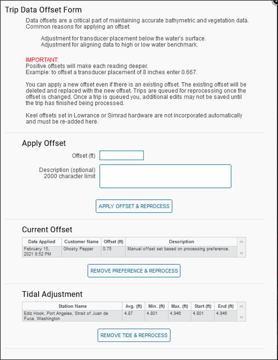
The image shown below is an example of a Data offset dialog that shows the automated tide offset to Mean Lower Low Water (MLLW) combined with a transducer depth offset on a selected trip. In this instance, depths were decreased on average by 3.5 ft to represent the state of habitat at MLLW tide.