Multiple users in an organization can contribute data to a centralized account and trip data can be merged to form a uniform output. For instance, the bathymetry map in a well-studied large lake will become increasingly accurate and precise if users log data each time they are on the water cumulatively covering greater areas.
If multiple users within your organization collect data within a defined time frame, data sets can be combined for a full lake view of the bathymetry and aquatic habitat.
Depth data can be grouped among all trips or users in an organization to provide constantly updated contours that improve over time. The kriging algorithm used in BioBase is an exact interpolator where adjacent data vary smoothly. The algorithm includes zero depths at shapefile boundaries and collected points to estimate depths where no data has been gathered.
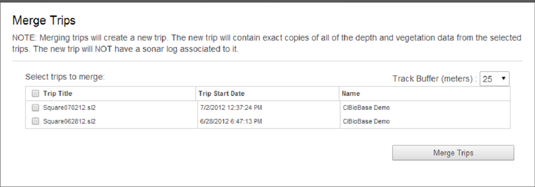
You can merge available trips from the Merge Trips dialog. The dialog can be accessed in the toolbar. Merged trips will be listed in the EcoSound Merges tab in your dashboard.
Example
The image shown below is an example of a Merge Trips dialog that shows a list of available trips that can be merged. The available trips listed on the dialog may be your own trips or shared trips from an organization that you are a member of.